[ home |
overview |
schedule |
lab reports |
lab notebook |
lab hours |
lab policies |
links ]
GEO 265 is offered every quarter.
FALL Term 2003
Section 002: WF 1:00 p.m. - 2:50 p.m
Digital Earth Classroom, Wilkinson 210
Lab is open M-F, 8:00 a.m. to 8:00 p.m.
View lab hours at dusk.geo.orst.edu/de/de_teach.html
Prerequisite: NONE but you SHOULD have had some basic experience with Windows computers and be able to perform basic tasks, such as moving, copying and deleting files, making and changing directories, working with simple word processers and graphics programs, and surfing the Internet.
Web Site URL: http://dusk.geo.orst.edu/arc
REQUIRED FOR CLASS: 1 zip disk or writeable CD-ROM, formatted for PCs. These are available from the OSU Bookstore.
Also, all students MUST have a SCIENCE account in order to use
the computers in Digital Earth. Mark Meyers, our lab manager, will create
an account for you, or should be contacted if you do not yet have an account. These accounts provide 200 Mb of local storage space. Each computer is equipped with CD-RW and 250 Mb zip drives.
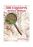
 REQUIRED Text: GIS Concepts and ArcView Methods
"Ideal for university GIS courses, this handbook bridges
the gap between user manuals and textbooks. It demonstrates the
concepts of GIS and the fundamentals of ArcView GIS software,
relating the how and why of operations together. The book covers
basic topics such as how to display, query, and edit shapefiles and
advanced topics such as how to construct complex spatial models
using Spatial Analyst and how to write programs using Avenue. For the
novice user, the GIS framework provides the context to understand, not
just how to use a particular function, but why and when it should be used.
For the advanced user, the book details many features and shortcuts
(some undocumented) that will make work sessions more productive. The book also
contains numerous references to other materials, including his a web
page with a number of FAQs, tips, and scripts." David Theobald, 1999,
198 pp., $40.00 (list), ISBN: 0-9679208-1-7. Description from the ESRI Bookstore Catalog
Book Web Site
|
 REQUIRED Text: GIS Concepts and ArcGIS Methods
"... combines the how and why into one complete reference. This book
bridges the information gap between user manuals and textbooks by fusing
ArcGIS methods and techniques with a compilation of basic geographical
concepts to benefit both beginners and experts. It is an ideal textbook
for introductory GIS courses as it demonstrates how to display, query,
edit, and analyze both feature and raster-based geographic data using
ArcGIS, all within the broader context of fundamental GIS concepts."
David Theobald, 2003, 198 pp., $55.00 (list), ISBN: 0-9679208-2-5.
Description from Conservation Planning Technologies
Book Web Site
|
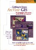
 Optional Text: Getting to Know ArcView GIS 3.x
Includes CD_ROM
"The CD packaged with this introductory book includes a working
demonstration copy of ArcView Version 3.x software, a hands-on
ArcView tutorial, and informative multimedia presentations.
Part I of the book is a nontechnical introduction to GIS technology,
while Part II offers illustrated, step-by-step procedures and tips for using
ArcView software to perform scores of GIS tasks. Readers can follow the
scenario-based exercises in the book or work through them on-line using
the data and software provided on the CD. The book is teeming with
full-color maps and illustrations that complement the book's easy-to-read
text. Readers will come away with a solid understanding of basic GIS
concepts and the skills they will need to embark on an ArcView project of
their own." Ormsby et al., 1998, 660 pp., $49.95 (list), ISBN: 1-879102-46-3.
Description from the ESRI Bookstore Catalog
|
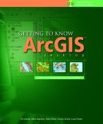
 Optional Text: Getting to Know ArcGIS Desktop
by Ormsby et al.
Includes CD_ROM
"Getting to Know ArcGIS Desktop is a workbook for learning ArcGIS,
the newest GIS technology from ESRI. The three GIS products that
comprise ArcGIS: ArcView, ArcEditor, and ArcInfo, are built on a common
interface and core capability, with each product offering a different
level of functionality. Users of Getting to Know ArcGIS Desktop gain
a thorough understanding of ArcView, which they can put to work
immediately or use as a firm foundation for learning ArcEditor and ArcInfo.
Getting to Know ArcGIS Desktop employs the teaching approach used
so effectively in the best-selling Getting to Know ArcView GIS from
ESRI Press. Richly detailed illustrations and step-by-step exercises teach
basic GIS tasks, from mapmaking, to spatial analysis, to database creation.
Readers learn to use the software that forms the building blocks of ArcGIS:
ArcMap, for displaying and querying maps; ArcCatalog, for managing
geographic data; and ArcToolbox, for setting map projections and converting
data. Also included in the book are explorations of the newest ESRI data
format, the geodatabase, which stores spatial and attribute information in
a relational database." ESRI Press, 2001, 552 pp., $59.95 (list), ISBN:
1-879102-89-7. Description from the ESRI Bookstore Catalog. Image used
by permission.
|
PURPOSE:
This course will provide you with a basic working knowledge of the
ArcView 3.x and ArcGIS 8.x software packages. You will be using the basic
functionality of these packages to:
- input and create maps of geographical locations and their attributes
- perform spatial analyses using spatial and attribute data
- display the results of the analyses in the form of maps and tables
FORMAT:
You will be spending most of your time working through exercises and
projects. The course will also include online modules from the ESRI
Virtual Campus. Although GEO 265 contains a little theory, it is
primarily a hands-on experience (take GEO 465/565 for fundamental theory and background on GIS). The
instructor and teaching assistant will spend a good portion of their class time in
one-on-one assistance. For each exercise, you will be preparing
a lab report, and throughout the term you
will be required to keep a lab notebook.
Although there will be time to work on exercises and projects in class, you should
expect to spend a considerable amount of time working in the lab outside the regular class
period.
Please listen when the instructor introduces new material to the class.
It will be very tempting to simply continue working on a current exercise, but then you run the risk of falling very far behind.
PROBLEMS?
We are not only working with individual computers, but with machines on a
network. And the ArcGIS software package in particular is not
always "user-friendly".
THINGS WILL GO WRONG! When they do, try the following:
- Re-read (or READ for the first time!) the instructions & examples. Exact
syntax is essential!!!!!!
- Exit the program and re-start it.
- Contact the instructor, TA, or support staff in the adjacent office for help.
- Shut everything down, take a break and start over again in an hour (some
inexperienced computer operators are surprised at how well this works!).
OTHER RESOURCES:
- Additional user documentation is available on the class web site.
- Digital Earth includes the John Pine Memorial Library with excellent books on GIS, remote sensing, and cartography, and additional copies of ESRI documentation. Please do not remove these books from the classroom!!
GRADING:
This is a hands-on practicuum designed primarily to teach you how to use
specific software packages. Approximately half of your grade will be based on a
series of exercises, the other half will be based on a major project.
The due date for each exercise and project will be announced in class
when distributed and posted on the class web site.
We will not accept any excuses for late papers. Points will be deducted for each day
that an exercise or project is late.
Please BE NEAT! Both organization and writing ability will be considered in the
assignment of grades. Please communicate as a professional.
Typically,
- Exercises 1-3 and 5 contribute a maximum of 10 pts. each toward the total grade
- Exercises 4, 6-8 --> 20 pts. each
- A mid-term exam --> 50 pts.
- A project --> 70 pts.
- Lab Notebook --> 40 pts.
- Attendance --> 20 pts.
The above is subject to slight alteration and we will, of course, announce this in class. There will be NO final exam.
[ home |
overview |
schedule |
lab reports |
lab notebook |
lab hours |
lab policies |
links ]
Last updated September 28, 2003
http://dusk.geo.orst.edu/arc/265desc.html
 REQUIRED Text: GIS Concepts and ArcView Methods
 REQUIRED Text: GIS Concepts and ArcGIS Methods
 Optional Text: Getting to Know ArcView GIS 3.x
 Optional Text: Getting to Know ArcGIS Desktop
by Ormsby et al.