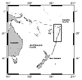
DATA to accompany:
"Bathymetry of the Tonga Trench and Forearc: A Map Series"
Marine Geophysical Researches

DATA to accompany:
"Bathymetry of the Tonga Trench and Forearc: A Map Series"
Marine Geophysical Researches
Dawn Wright
College of Earth, Ocean, and Atmospheric Sciences
Oregon State University
Corvallis, OR 97331-5506
dwright@esri.com
Have old-style GMT grids like the ones below that need to get into ArcGIS 9/10? In latest version of GMT do: grdreformat -fg oldformat.grd newformat.nc
Map 1 grid (all data, 1.5Mb)
Map 1 SB2K grid (Sea Beam 2000 data only, 632K)
Map 2 grid (all data, 1.9Mb)
Map 2 SB2K grid (Sea Beam 2000 data only, 1Mb)
Map 3 grid (all data, 2.1Mb)
Map 4 grid (all data, 831K)
Here are the color POSTSCRIPT FILES of the maps so that you can
print them out on your own plotter.
To download, hold down RIGHT mouse button and select "Save Link As":
Map 1 Postscript File (394K)
Map 2 Postscript File (484K)
Map 3 Postscript File (380K)
Map 4 Postscript File (229K)
Original Sea Beam 2000 ping-edited data (from Boomerang 8 only) are available here in an 88 Mb compressed tar file.
Data list for Map 1
Data list for Map 2
Data list for Map 3
Data list for Map 4
Contact Dawn for older Sea Beam and other digital data.
Figure 7 grid (1.2Mb)
Figure 8 grid (1.9Mb)
Figure 9 grid (3.2Mb)
Figure 10 grid (1.4Mb)
Figure 11 grid (641K)
Figure 12 grid (550K)
Here are the color POSTSCRIPT FILES of the figures so that you can
print them out on your own printer.
To download, hold down RIGHT mouse button and select "Save Link As":
Figure 7 shaded relief (2.4Mb)
Figure 8 shaded relief (4.3Mb)
Figure 9 (7.6Mb)
Figure 10 (587K)
Figure 11 (1.3Mb)
Figure 12 (1.7Mb)
 Go Back Go Back |