| |

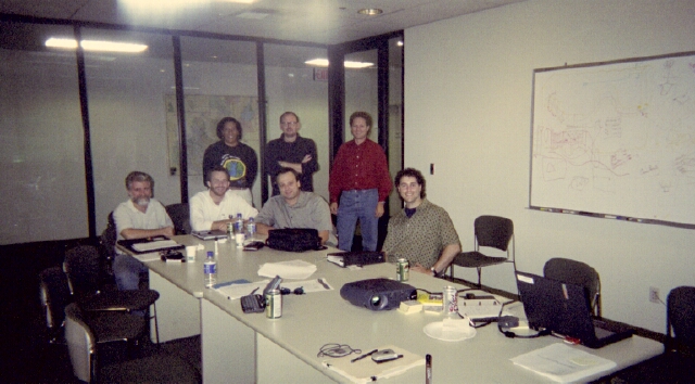
 Original ArcGIS Marine Data Model Working Group, Oct 2001
 Click image to enlarge Click image to enlarge
The Process (817K gif image)
Milestones
Oct 4-5 2001 - Initial working group meeting in Redlands, CA
Nov 2001 - Draft conceptual framework document completed
early 2002 - Conceptual framework circulated and
critiqued
Jun 7-8 2002 - Core and review team workshop #2 to refine model, Redlands
Jul 9 2002 - ESRI User Conference,
Model introduced at Marine SIG meeting
Jul 2002 - Publish draft model
Jul-Nov 2002 - Project work to further refine model
Nov 1 2002 -
Web conference to discuss major updates,
release of test data
early 2003 - Review period for updated
model
May 16-18 2003 -
Workshop #3 to refine and finalize model, Redlands
Jul 9 2003 - ESRI User Conference, Marine Data Model
Technical Workshop
Ongoing - Case study development, moving model to beta
Aug 2004 - ESRI User Conference, Marine Data Model Technical
Workshop and Case
Study Paper Session
Feb 2005 - Book contract with ESRI Press secured
Jul 2005 -
ESRI User Conference, Arc Marine Technical Workshop
Aug 2005 - Lead authors' meeting, ESRI Press, Redlands
Jun 30 2006 - Deadline for manuscript submission to ESRI Press
June 2007 - Publish final data model as book from ESRI Press
|
|
 | |
|
Over the past several years ESRI, with a significant amount of user community
input, has been engaged in the exercise of building "industry-specific"
data models for ArcGIS. There are a number of efforts currently underway
in most of the industries and scientific disciplines that ESRI serves (e.g.,
transportion, land parcels, and energy utilities; forestry,
surface hydrology, and conservation/biodiversity). The marine
community joined the fray in 2001! By "marine community"
we mean people who apply GIS to the coasts, estuaries, marginal seas, and/or
the deep ocean: academic, government or military oceanographers,
coastal resource managers and consultants, marine technologists, nautical
archaeologists, marine conservationists, marine and coastal
geographers, fisheries managers and scientists, ocean explorers/mariners,
etc.
The ArcGIS Marine Data Model represents a new approach to spatial
modeling via improved integration of many
important features of the ocean realm, both natural and manmade.
The goal is to provide more accurate representations of location
and spatial extent, along with a means for conducting more
complex spatial analyses of marine and coastal data by
capturing the behavior of real-world objects in a geodatabase.
The model also considers how marine and coastal data might be more
effectively integrated in 3-D space and time. Although currently
limited to 2.5-D, the model includes "placeholders" meant to represent
the fluidity of ocean data and processes.
For users, an ArcGIS data model provides a basic template
for implementing GIS projects (i.e., inputting, formatting,
geoprocessing, and sharing data, creating maps, performing analyses, etc.);
for developers, it provides a basic framework for writing program
code and maintaining applications. A key advantage of the data model is
that it should help users to take
fuller advantage of the most advanced manipulation and analysis
capabilities of ArcGIS,
particularly its support of more complex rules that can be built
into its geodatabases, and of objects with not only attributes,
but database rules (rudimentary behavior). ArcGIS data models also support existing data
standards, so as to help simplify the integration of data at various
jurisdictional levels (i.e., local, state/provincial, national, global).
Specific goals of the model include:
-
production of a common structure, a "geodatabase template",
for assembling, managing, and publishing marine data in ArcGIS.
For example:
-
because UML code is easily converted to an ArcGIS geodatabase,
users can immediately begin populating the geodatabase rather than
having to design it from scratch.
-
users can produce, share, and exchange data in similar formats
-
unified approaches encourage development teams to extend and
improve ArcGIS software.
-
extending the power of marine GIS analyses by providing a framework for
incorporating behaviors in data, and dealing more effectively
with scale dependencies.
-
providing a mechanism for the implementation of data content
standards, such as the FGDC's Hydrography Data Content Standard
for Inland and Coastal Waterways,
critical for the Coastal National Spatial Data
Infrastructure.
-
and perhaps in the final analysis, helping many users to really
learn and understand the ArcGIS geodatabase! For instance, in the core
ArcGIS
data model, arc-node topology can be used in conjunction with
other new and powerful data structures. Routes and regions are
relegated to feature classes. And relationships between tables
can be preserved, maintained, and easily managed.
The sidebar to the left shows a summary of the steps
along the way in the process of building the Arc Marine data
model, including completion milestones to date.
BACK TO TOP
Last update: October 26, 2011
© 2001-present, D. Wright and OSU Webworks
http://dusk.geo.orst.edu/djl/arcgis/about.html
|
| |
|
 Original ArcGIS Marine Data Model Working Group, Oct 2001
