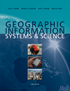
Longley, Goodchild, Maguire, and Rhind, 2010/2011, Third Edition, John Wiley and Sons
ISBN: 978-0-470-72144-5
Spring 2011, 4 credits
Web Site: http://dusk.geo.orst.edu/buffgis
Prerequisite: GEO 465/565 or an upper division/graduate, intermediate level course in GIS

| REQUIRED Text:
Geographic Information Systems and Science Longley, Goodchild, Maguire, and Rhind, 2010/2011, Third Edition, John Wiley and Sons ISBN: 978-0-470-72144-5
|

| OPTIONAL Text:
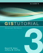
GIS Tutorial 3: Advanced Workbook Allen and Coffey, 2010, ESRI Press ISBN: 978-0-470-72144-5
|

|
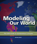
OPTIONAL Text: Modeling Our World Michael Zeiler, 2010, ESRI Press, Second Edition ISBN: 9781589482784
|

|
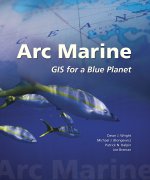
OPTIONAL Text: Arc Marine: GIS for a Blue Planet Wright, Blongewicz, Halpin, and Breman, 2007, ESRI Press, ISBN 978-1-58948-017-9
|

|
OPTIONAL Text: Designing Geodatabases
David Arctur and Michael Zeiler, 2004, ESRI Press, ISBN:1-58948-021-X
|
| OPTIONAL Text: Map Analysis: Procedures
and Applications in GIS Modeling Joseph K. Berry, 2001, BASIS Press Completely Online (www.innovativegis.com/basis/MapAnalysis/ )
|
Course Objectives: GEO 580 will take graduate students beyond the development of geographic mapping technology that simply answers the question, "Where is it?" to integrated systems and the foundational geographic information science that help us answer the question, "Why is it?" Designed as the "sequel" to the introductory course in GIS (GEO 465/565), GEO 580 will cover technical topics that we didn't have time to cover in GEO 465/565 while broadening the base of GIS theory established in that introductory course. Occasional discussion of the latest developments published in the GIS/geography literature and/or on the World Wide Web will reinforce this and foster an appreciation of GIS as an effective analytical tool for understanding complex processes. Each student will choose between: (1) a series or rigorous exercises in ArcGIS; or (2) completion and presentation of an 8-week long analytical project that will apply the concepts discussed in class.
Learning Outcomes - By the end of the course it is expected that students will be able to:
Grading: For students doing option (1), the midterm will be worth 30%, the final 30%, the labs 40%, (including the required ArcGIS data model exercise). For students doing option (2), the midterm will be worth 30%, the project 50%, and Labs 1-3 plus the data model exercise 20% (no final exam).
Lecture/Discussion Topics to Include:
Week 10 - Poster Presentations of Projects
Final Exam - Monday, June 6th, 6:00-8:00 p.m.
Library Info: As you know, we have a wonderful library on campus! See the Reference Services page at osulibrary.orst.edu/reference.
You can access most of the library's databases at osulibrary.orst.edu/research.html from outside of the library or off campus.
To obtain materials not in our collection, Interlibrary Loan forms for books and journal articles can be found at osulibrary.orst.edu/ill.
There is a single GIS workstation in the library, running ArcGIS 9.x and several other related applications. Contact the Map Library for access and use policies.
Student conduct is governed by the university’s policies, as explained in the Office of Student Conduct: Information and Regulations at oregonstate.edu/studentconduct/.
Last update: March 25, 2011
http://dusk.geo.orst.edu/buffgis/580desc.html
© 2000-2011 Dawn Wright